For decades, the construction and remodeling industry relied on a fundamentally flawed process for creating As-Built drawings: sending a team with tape measures, laser distos, and clipboards to manually record room dimensions. This manual method is slow, prone to human error, and almost guarantees that critical measurements (like ceiling deflections or un-plumb walls) will be missed.
Enter Terrestrial 3D Laser Scanning (LiDAR).
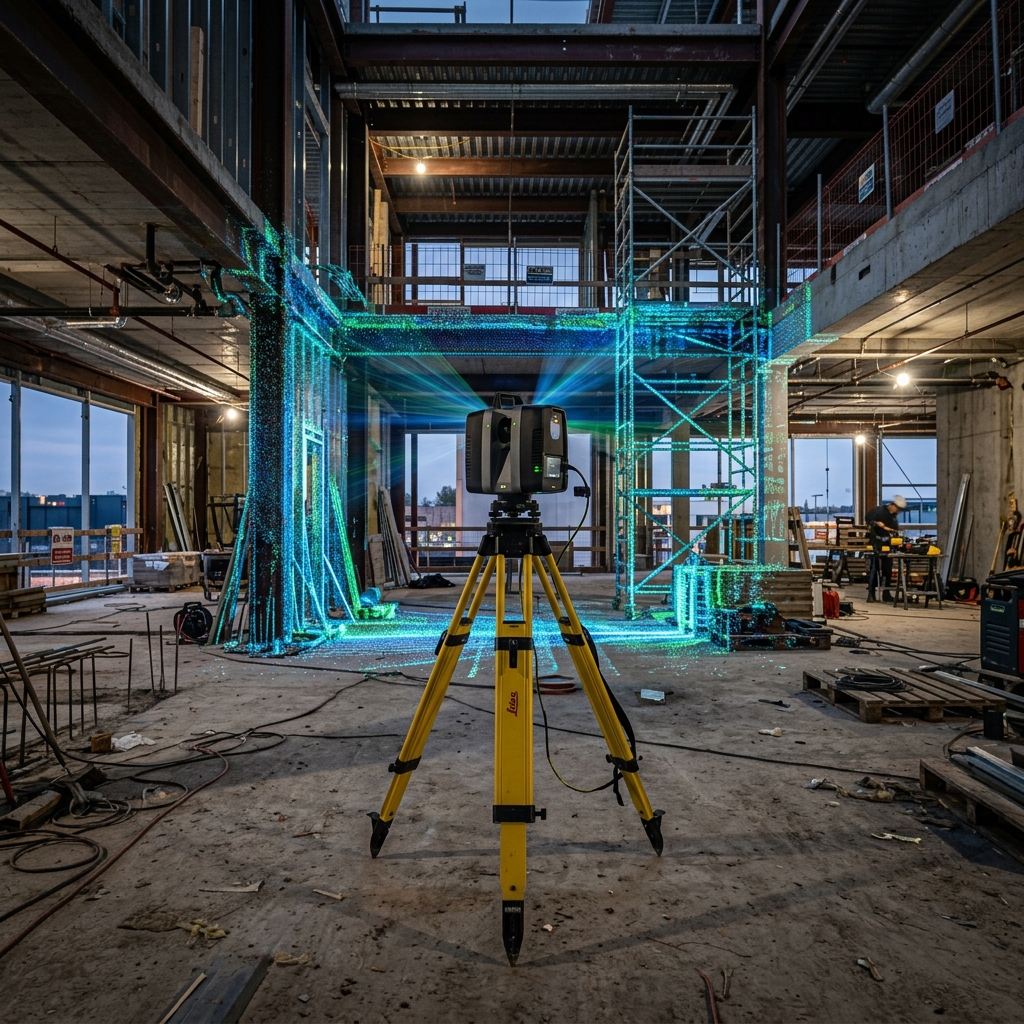
What is AEC Laser Scanning?
Instead of measuring point-to-point, an industrial laser scanner (mounted on a tripod) spins 360 degrees, firing millions of laser pulses per second. It measures the exact distance to every surface in the room—walls, pipes, structural beams, and HVAC ducts.
The result is a Point Cloud: a highly accurate 3D digital replica of the physical space, composed of billions of millimeter-accurate data points.
The ROI of 3D Scanning in Construction
1. Eliminating "Return Trips"
With manual measuring, missing a single critical dimension means sending the surveying team back to the site, wasting days and delaying the project. With a 3D scan, the entire environment is captured. If you forgot to measure the height of a specific pipe, you simply open the Point Cloud on your computer and measure it virtually.
2. Clash Detection
Before installing expensive new HVAC routing or structural steel, engineers can overlay their new CAD/BIM models directly onto the Point Cloud of the existing building. This allows them to perform Clash Detection—identifying exactly where a new pipe will hit an existing concrete beam before anyone steps foot on site. Fixing a clash in CAD costs pennies; fixing it during installation costs thousands.
3. Verification of Contractor Work
Scanning isn't just for the start of a project. Progressive scanning allows project managers to verify that contractors poured concrete or erected steel exactly according to the blueprints. By comparing the fresh scan against the design CAD, deviations of even a quarter-inch are instantly highlighted in red.
Why Replix3D?
At Replix3D, we deploy top-tier LiDAR equipment to capture your site with incredible accuracy. But we don't just hand you a massive, hard-to-use Point Cloud file. Our in-house engineers process the data and deliver clean, ready-to-use Revit BIM models or AutoCAD floor plans.
Ready to modernize your workflow? Learn more about our Architectural Scanning Services.